Fógra
WARNING: It should be noted that these sites are unguided and a level of care and caution should be maintained during all stages of your visit. The Office Of Public Works (OPW) will not be held responsible for any damages, injuries, or losses that occur
St. John’s Augustinian Priory
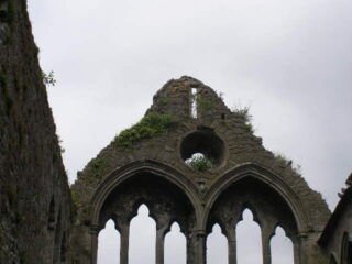
Located off John Street Lower, on the northern back of the river Nore in Kilkenny, the upstanding remains of the medieval St. John’s Abbey stand beside a later Church of Ireland church. Dedicated to St. John the Evangelist, the Priory was founded by the renowned Norman knight, William Marshall, around the year 1211 A.D. Initially consisting of a nave and chancel, a tower, at the junction of the two, was added later in the 13th century. A Lady Chapel was added to the complex in 1290 and thirty five years later the priory underwent extensive reconstruction. The bell tower of the priory collapsed around 1330 and would not be rebuilt until the 15th century. Interestingly, in 1331, the Prior and the community of the Priory were arrested and imprisoned by the Lord Justice of Ireland for reasons that are now lost to time.
During the dissolution of the monasteries by Henry VIII the Priory was surrendered in March 1540 and the property and lands granted to the Corporation of Kilkenny. At the time of the surrender the Priory buildings and areas consisted of a “church, belfry and cemetery, a hall, dormitory, six chambers, a kitchen, store, granary, two orchards, three gardens and sundry other closes, containing four acres, within the precincts of the Priory”. By 1615 it was noted that the nave and chancel of the Priory were in ruins, and by 1628 the precinct and lands formerly held by St. John’s were in the possession of Kilkenny merchant families such as the Rothes, Archdekins, Shees and Langtons.
The following century, during the time of the Catholic Confederation in 1645, Jesuits established a short lived chapel and seminary within the former Priory. In the late 18th century the nave of the priory was demolished, along with a number of other buildings, and the stone was used in the construction of a military barracks. In 1817 the Lady Chapel was re-roofed and converted to use as a Church of Ireland church dedicated to St. John.
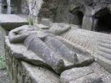
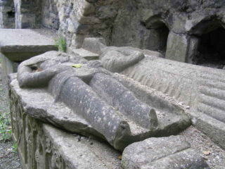
Within the surviving ruin of the chancel is a tomb with two effigies, one depicting a knight and the other his wife. The damaged knight, missing his head and feet, is shown dressed in armour and armed with a sword, while the lady is dressed in a long gown and wears a horned headdress. An inscription, in Latin, tells us that the figures represent a Purcell knight and his wife Johanna and also mentioned in the inscription is a date of 1500 for the death of Johanna. On the front and side panels of the tomb a series of figures are carved in niches, these include saints such as Andrew, James Major, John, Thomas, Philip, etc. The tomb appears to be the work of the famous O’Tunney sculptural workshop.
Visit Historic Environment Viewer for more information on St. John’s Priory
Protect our Past - Click here to read about the importance of protecting our country’s unique heritage sites
This national monument is protected in accordance with the National Monuments Acts 1930 to 2014
Gailearaí
Suíomhanna cóngarach
Caisleán Chill Chainnigh
An tseoid is luachmhaire i gcathair dhraíochtúil mheánaoiseach
Timpeall 0.5 km ón
Dearc Fhearna
Áit spéisiúil uathúil ina dtagann an stair agus an gheolaíocht le chéile
Timpeall 8.9 km ón
Teampall Mhuire, Gabhrán
Eaglais in bhfuil clocha oghaim, samhlacha de ridirí agus cuimhneacháin nuachlasaiceacha
Timpeall 12.4 km ón
Prióireacht Cheanannais
Tabhair cuairt ar an suíomh eaglasta iata is mó in Éirinn
Timpeall 12.9 km ón
Mainistir Chistéirseach Sheireapúin
Ceann de na fothracha Cistéirseacha is breátha in Éirinn
Timpeall 16.9 km ón
Teach Cogaidh an Ghorta Mhóir 1848
Suíomh neamhghnách inar tharla eachtra fhuilteach
Timpeall 19.2 km ón


