Notice
St. Laurence’s Gate is a National Monument in state guardianship
WARNING: It should be noted that these sites are unguided and a level of care and caution should be maintained during all stages of your visit. The Office Of Public Works (OPW) will not be held responsible for any damages, injuries, or losses that occur
St. Laurence’s Gate
Drogheda, or Droichead Átha in Irish, derives its name from the 'bridge of the ford' on the River Boyne. In AD 1172, on the high ground overlooking this ford, Hugh de Lacy (c.1135-1186), Lord of Meath, began constructing a wooden fort on behalf of King Henry II (1133-1189). The town’s charter was granted by de Lacy in 1194 and it is after him that de Lacy Bridge is named. The first stone bridge was erected in 1200. On his tour through the Pale in 1185, Prince John (1166-1216) visited the town, returning, after his coronation in 1199, as King in 1210. In 1204 the town was granted a 'Murage’ charter. Taking its title from ‘Le mur’, the French for wall, it allowed a tax to be levied on imports so as to pay for the building of protective walls and gates.
Regarding the erection of the town’s gates, in 1334 the Anglo-Normans completed the building of the town walls, enclosing an area of 113 acres, thereby creating one of the largest walled towns in the country and making Drogheda one of their primary strongholds.
The present town emerged from the joining together of two separate villages, one on the southern side of the Boyne (St. Mary’s parish) and the other on the northern side (St. Peter’s parish), and officially became what it is today in 1412. At just four miles inland from the mouth of an easily navigable section of the Boyne it gradually established itself as an important centre of import and export trade.
In the Fitzwilliam Museum, Cambridge, a drawing by Francis Place (1647-1728), entitled 'A View of Drogheda from St John’s Hill, 1698', reveals that the now-disappeared West Gate, also known as St. James’ Gate, was an almost mirror image of the east-facing St. Laurence’s Gate. As part of the gradual destruction of the town’s gates and walls, in the early 1800s, the stones of West Gate were offered for auction at the Tholsel. Other gates that have long since vanished include The Butter, or Buttress, Gate; the Fair Gate; Catherine’s Gate; the Blind Gate; the Duleek Gate; and St. John’s Gate.
In 1863, the historian John D’Alton wrote: "All the gates existed prior to a period of about sixty years ago (c.1803), and it is within the recollection of many, how solemnly they used to be closed at the ninth hour, and a watchman assigned to each, through which ingress or egress might be obtained till midnight, when the keys were all deposited in the central guard-house, and no further thoroughfare tolerated until morning."
By 1878, a report in 'Our Own Country’ magazine declared that the walls and the remnants of the gates of the town were in a ruinous condition. "The castles, too, that protected the walls have been battered down, and scarce a trace of them remains." Today only very small sections of this once-magnificent defensive structure exist, highlighting the importance of St. Laurence’s Gate as an example of its past formidable presence.
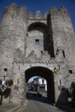
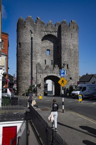
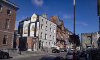
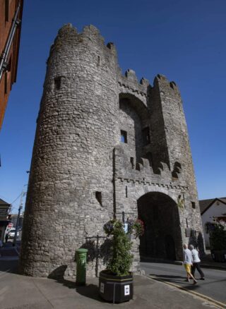
Dating from the 13th century, St. Laurence’s Gate is the only remaining one of the extensive defences that once encircled the town. Although described as a gate, the present structure is actually a barbican, consisting of a defensive pair of fortified circular towers which would have stood in front of the actual gate in the town wall. Defensive arrow-slits are still visible at each floor level and aspect of the two towers.
A deep ditch would have been dug between the entrance to the barbican and the town gate, over which a drawbridge would have spanned. These gates served to not only protect the town but they also had an economic purpose to control access to the markets and act as collection points for taxes on merchants’ produce. Entry through St. Laurence’s Gate led to the Priory of St. Laurence the Martyr, from whom is takes its name.
Originally built in a 13th century style known as “random stone building”, using all sorts of available stones of varying sizes, the gate was heightened in the 15th century, allowing for more formidable battlements to be incorporated, and for an arch to be constructed on the interior side.
A story recorded in the archives of the National Folklore Collection at University College Dublin states that an underground tunnel runs from St. Laurence’s Gate to the Chord cemetery (www.duchas.ie).
In 2017, campaigners successfully had the gate closed to traffic, to protect it from traffic vibrations, as well as car and truck fuel fume pollution.
Visit Historic Environment Viewer for more information on St. Laurence’s Gate
Protect our Past - Click here to read about the importance of protecting our country’s unique heritage sites
This national monument is protected in accordance with the National Monuments Acts 1930 to 2014
Gallery
Nearby sites to visit
Battle of the Boyne Visitor Centre – Oldbridge Estate
Where two kings fought for Europe’s future
Approx. 4.8 km from St. Laurence’s Gate
Brú na Bóinne Visitor Centre: Newgrange, Knowth and Dowth
Step into Ireland’s richest archaeological landscape
Approx. 7.2 km from St. Laurence’s Gate
Old Mellifont Cistercian Abbey Monastic Site
Visit Ireland’s very first Cistercian foundation
Approx. 8.3 km from St. Laurence’s Gate


